Frontend systemsBuilding responsive product surfaces with clear interaction.
ReactReduxJavaScriptHTMLCSSFigmaUI design
Frontend + spatial UX
Frontend developer with a background in geographic information systems and remote sensing.
I build readable, polished web interfaces with a strong interest in spatial data, maps, and immersive browser experiences.

About
I combine web application development and interface design with hands-on experience interpreting satellite imagery and working with spatial data. My work is strongest where clear interfaces, technical detail, and geospatial thinking meet.
Bachelor's degree, Czech University of Life Sciences Prague
Frontend development, user interface design, and geospatial data
Toolkit
A compact stack for building spatial products: interface systems, geodata workflows, and the observation habits that keep the work grounded.
Selected work
Public references from Gisat and LUISA, rewritten as concise portfolio archive entries.
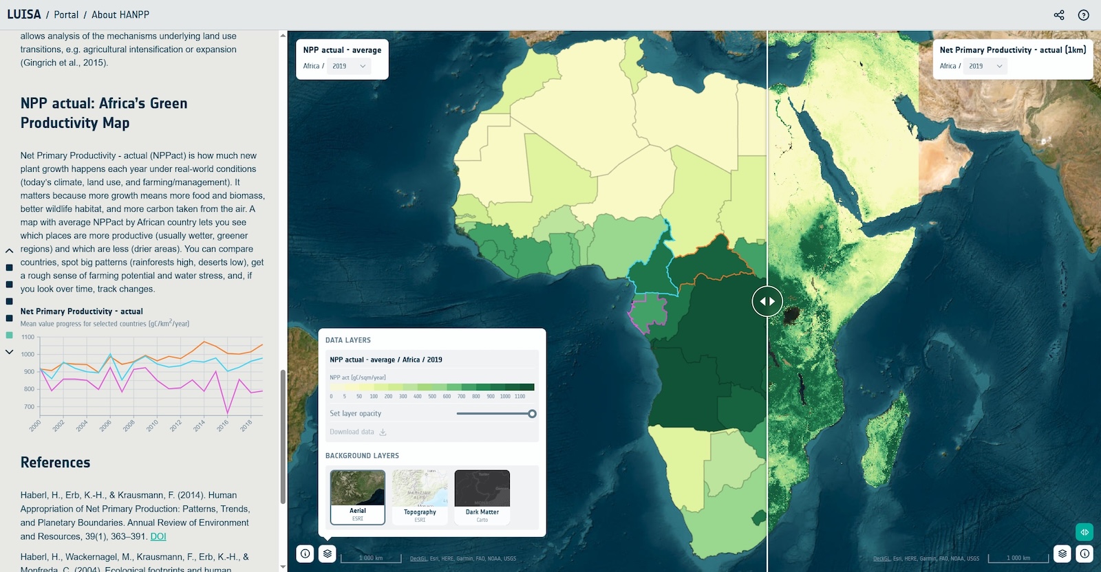
Continental Africa decision-support work around land-use intensity, HANPP indicators, crop yield, carrying capacity, and sustainable agriculture resilience.
Open LUISA portal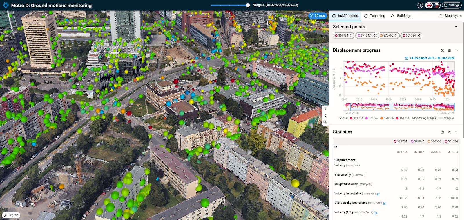
Multi-source infrastructure monitoring for Prague Metro D, using MT-InSAR deformation analysis, dense measurement coverage, and an investor-facing monitoring application.
Open Gisat case studyContact
Available for collaboration, frontend work, spatial interfaces, and projects where design clarity matters.